 Skip to content
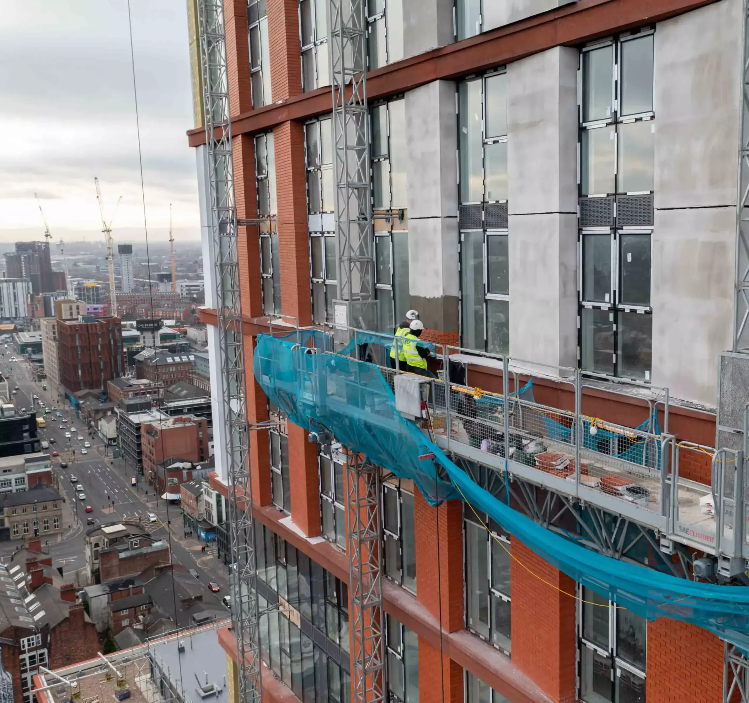
Drone Surveying of the Highest Quality
At ACS, we provide exceptional value whilst ensuring the most comprehensive and highest quality of work. This is why we are leaders when it comes to UAV drone surveying in construction and housing.
Operating across the UK, we provide a turnkey service including feasibility reviews and bespoke solutions, delivered within unbeatable timeframes, ensuring customer satisfaction.
Drone Surveying Benefits
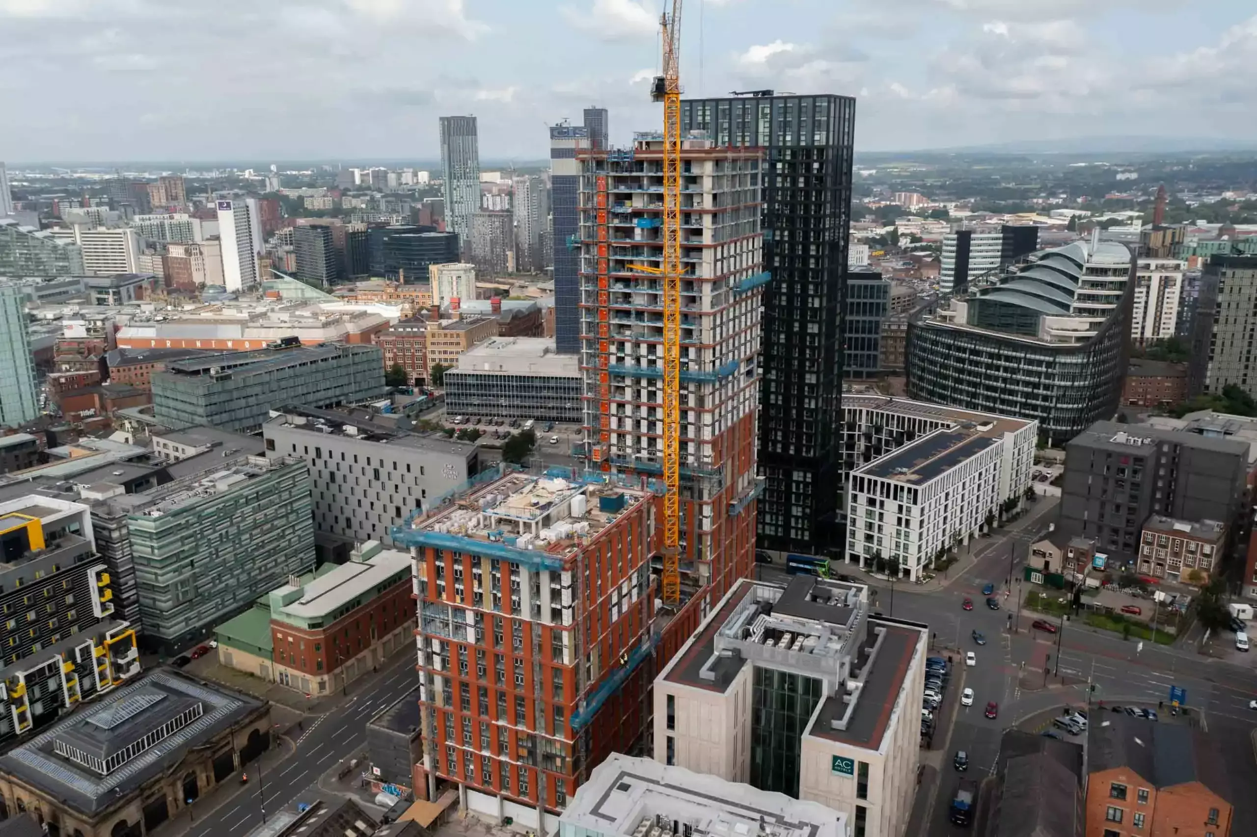
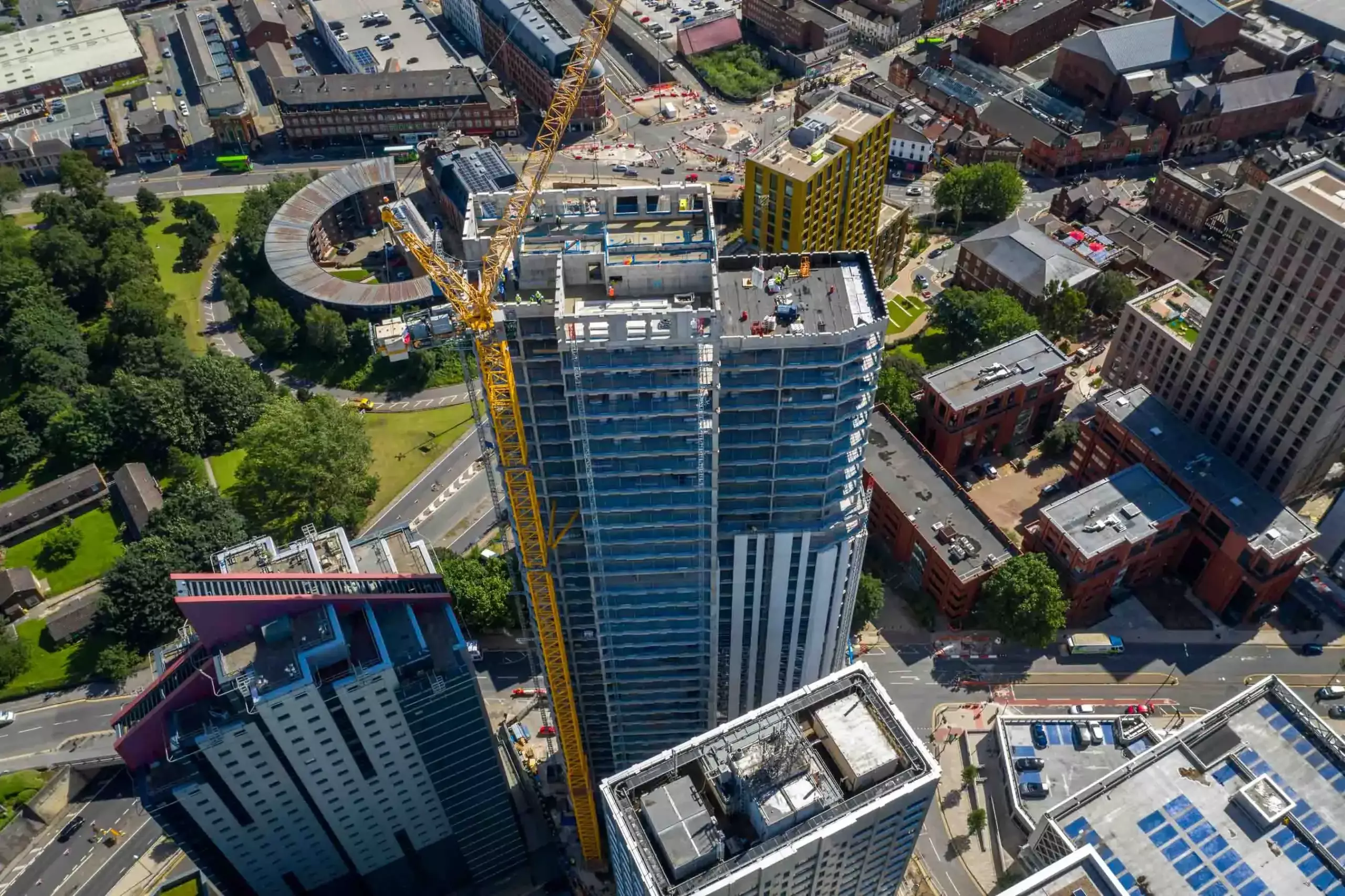
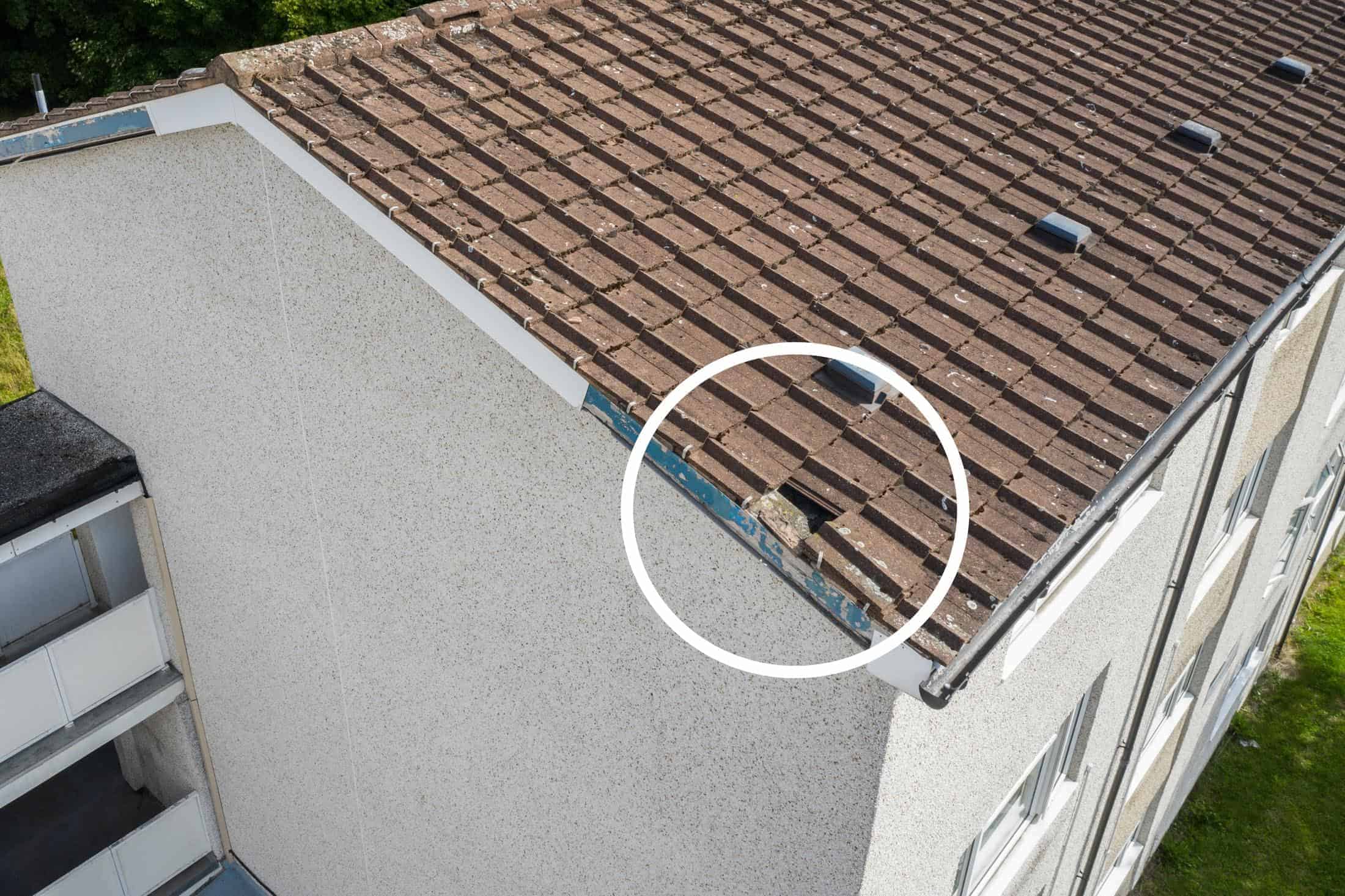
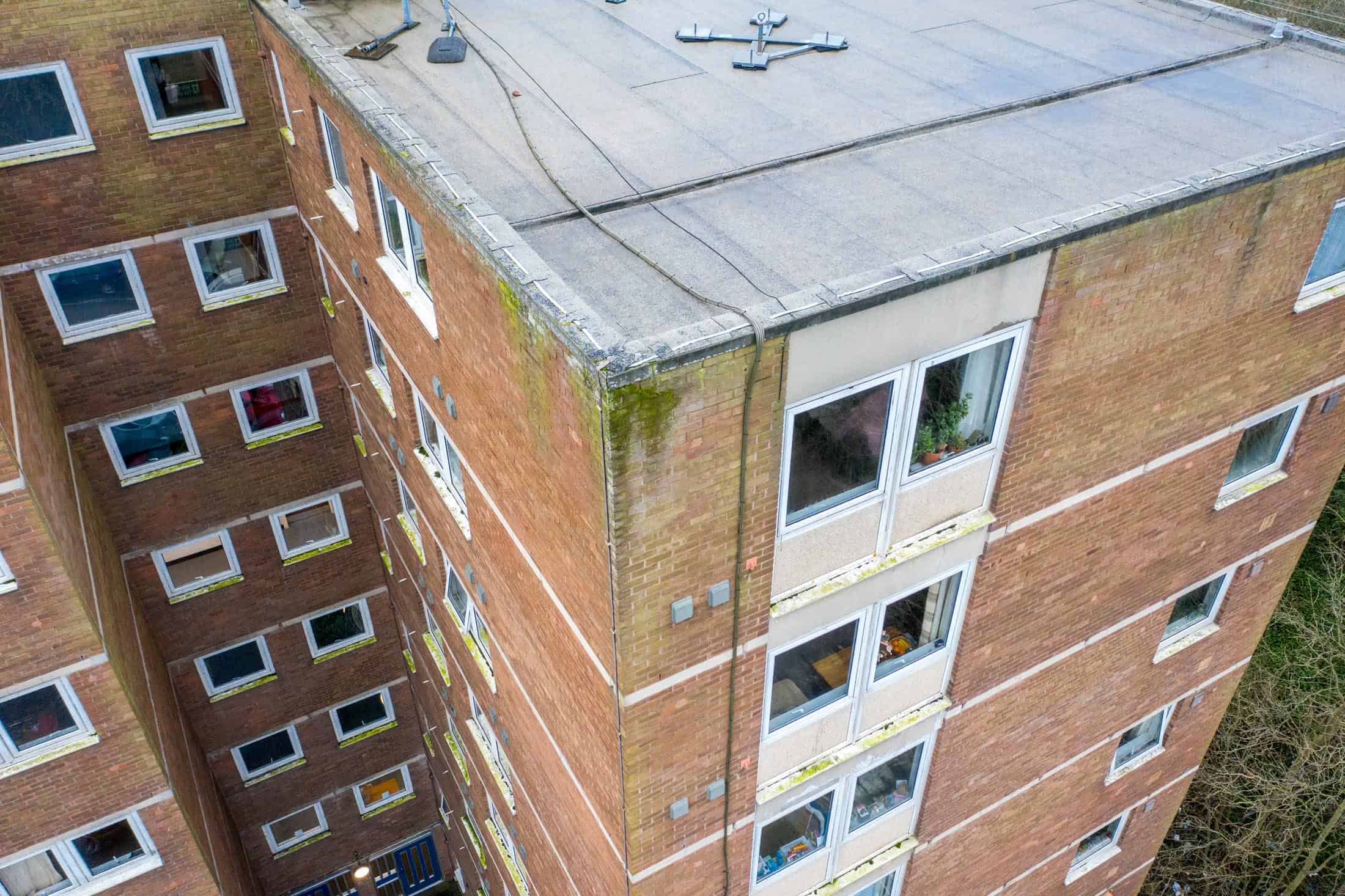
When it comes to UAV drone surveying in construction and housing, no one does it better than Aerial Construction Services.
Drone Surveying Services
Qualified & Affordable
The following construction-related accreditations are also in place due to the UAV (Drone) surveying taking place on construction sites: CHAS, CSCS, FCIOB, SMSTS (Site Manager Safety Training Scheme), First Aid at Work and Mental Health First Aid.

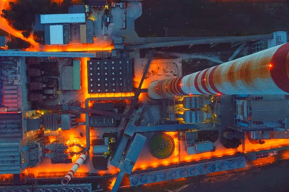
Aerial Filming
Aerial filming and photography are the most effective forms for marketing and business development. Our aerial footage provides a unique perspective, allowing clients to communicate projects to others effectively.
Our experienced award-winning cinematographers deliver an unrivalled service by using the latest technologies. We film in 4K, photograph in high-definition, automatically track and follow objects, and produce timelapse imagery if requested.
We are dedicated to construction and housing and hold the relevant CAA licenses and requisite insurances, allowing us to fly legally and safely.

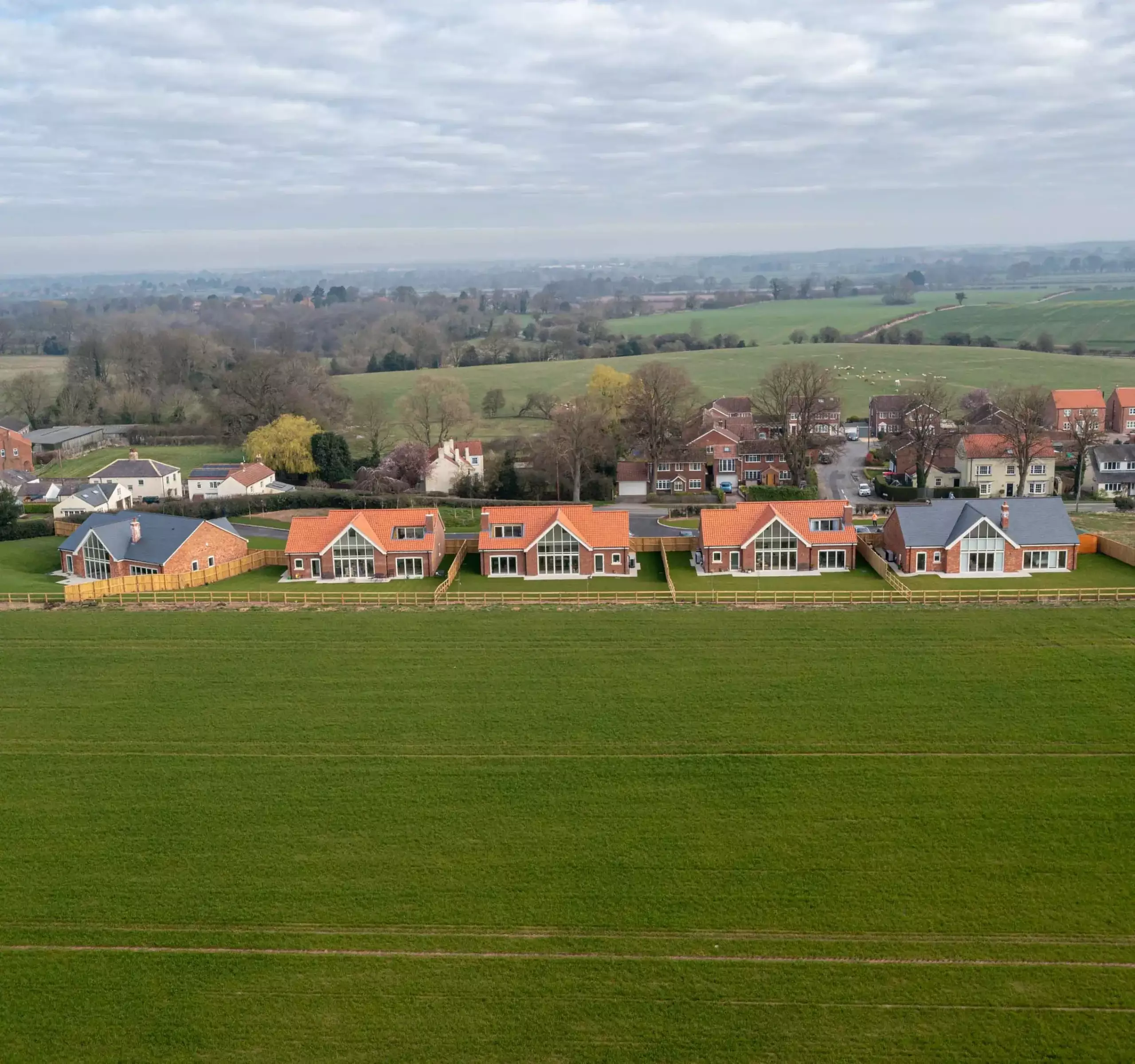
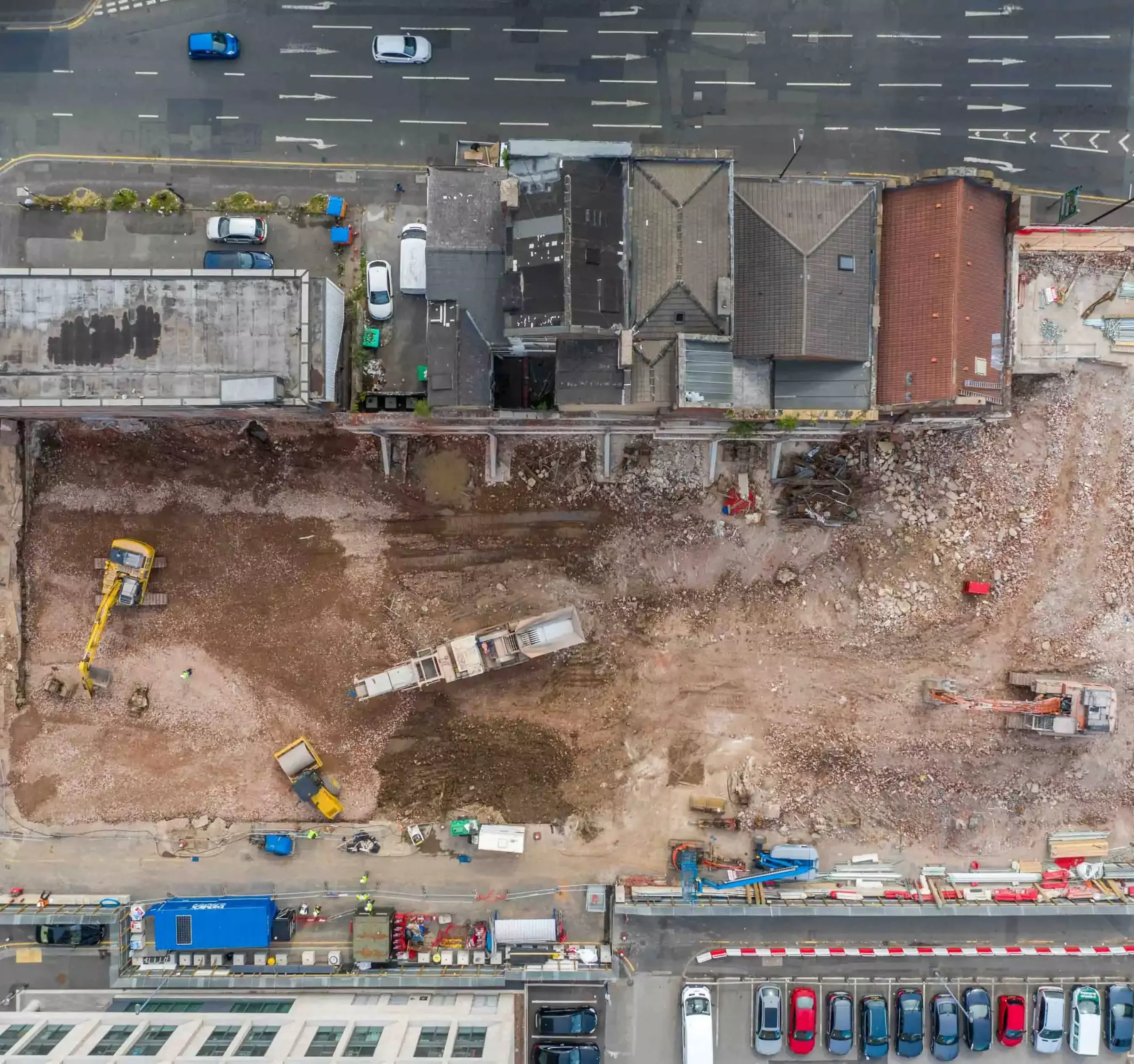
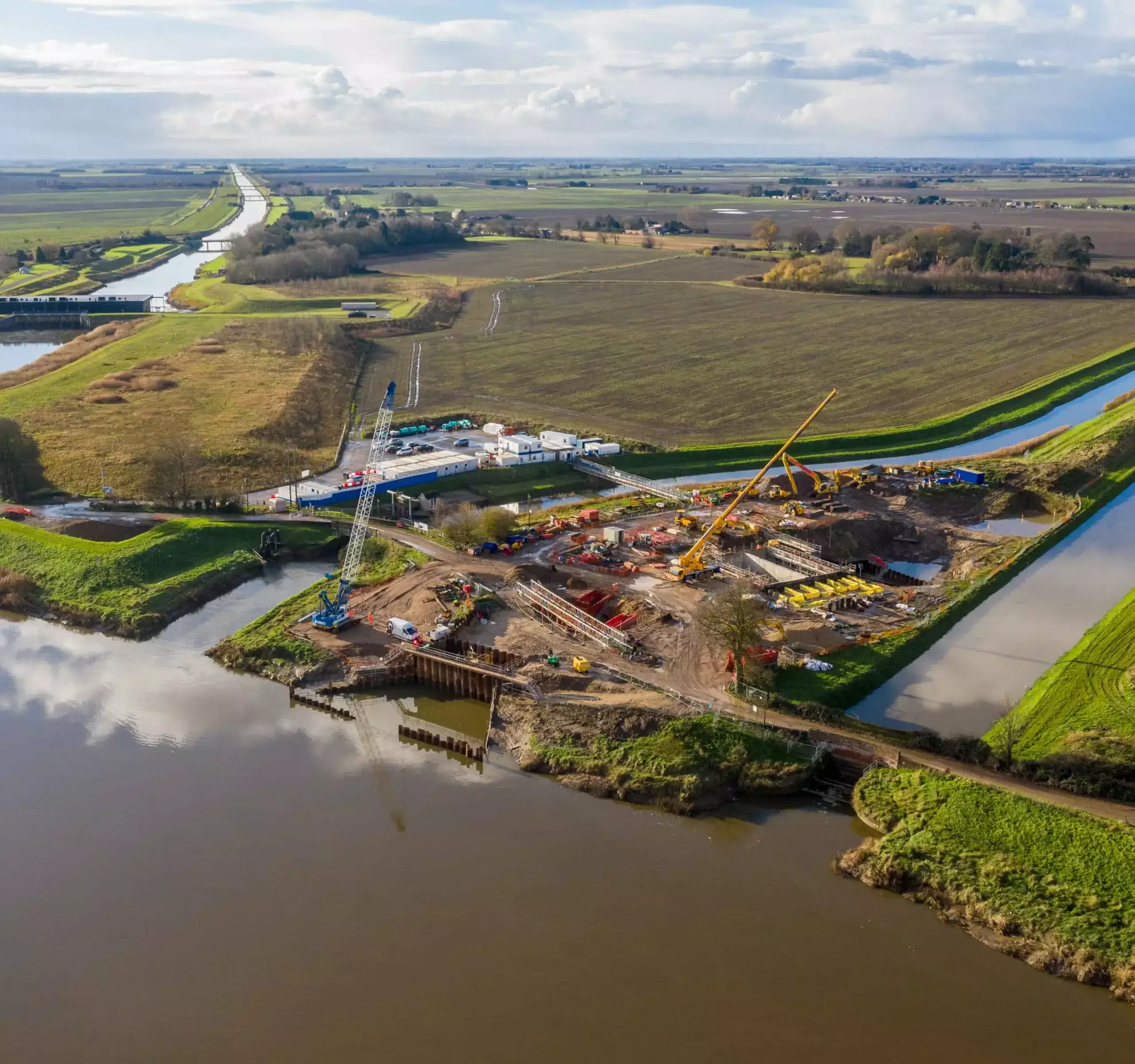
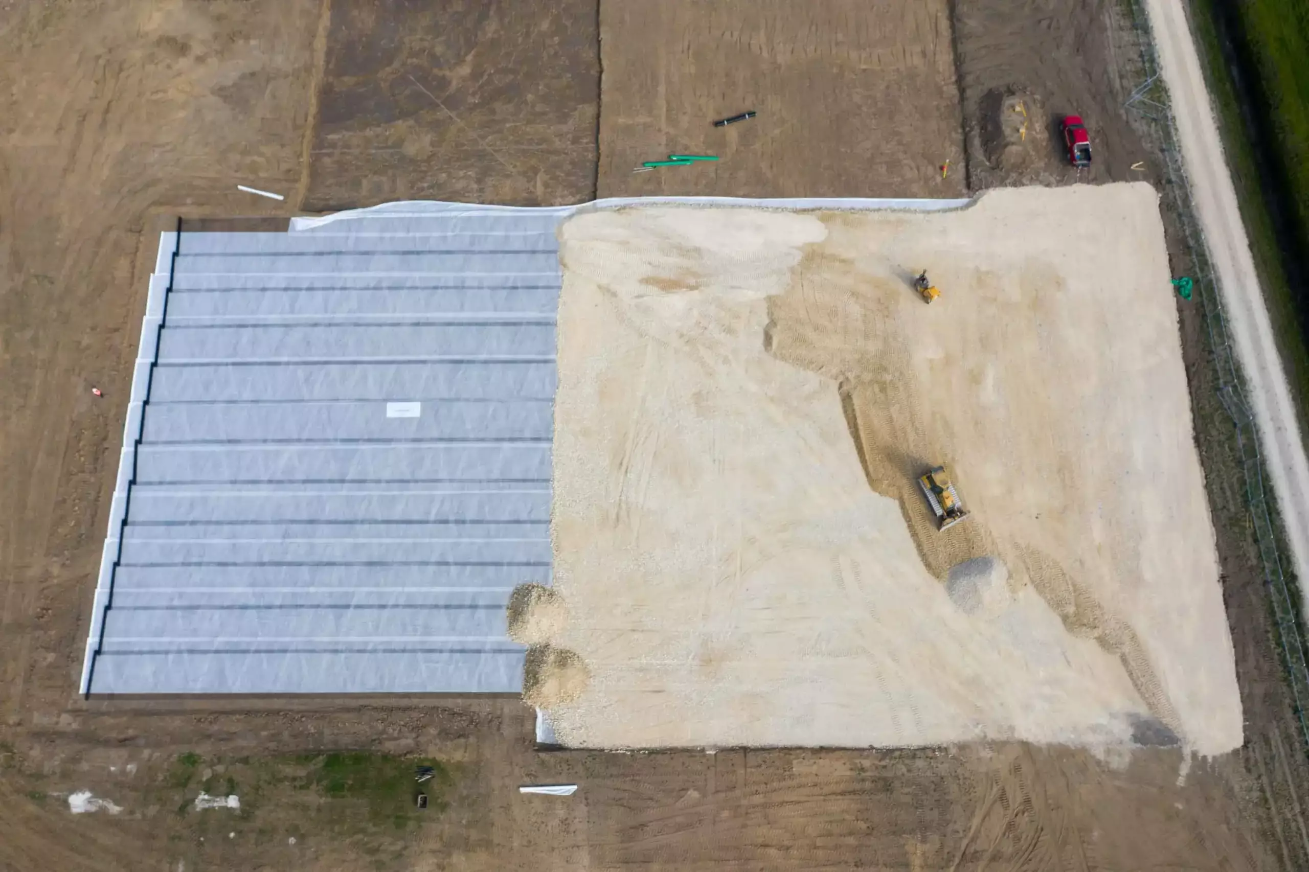
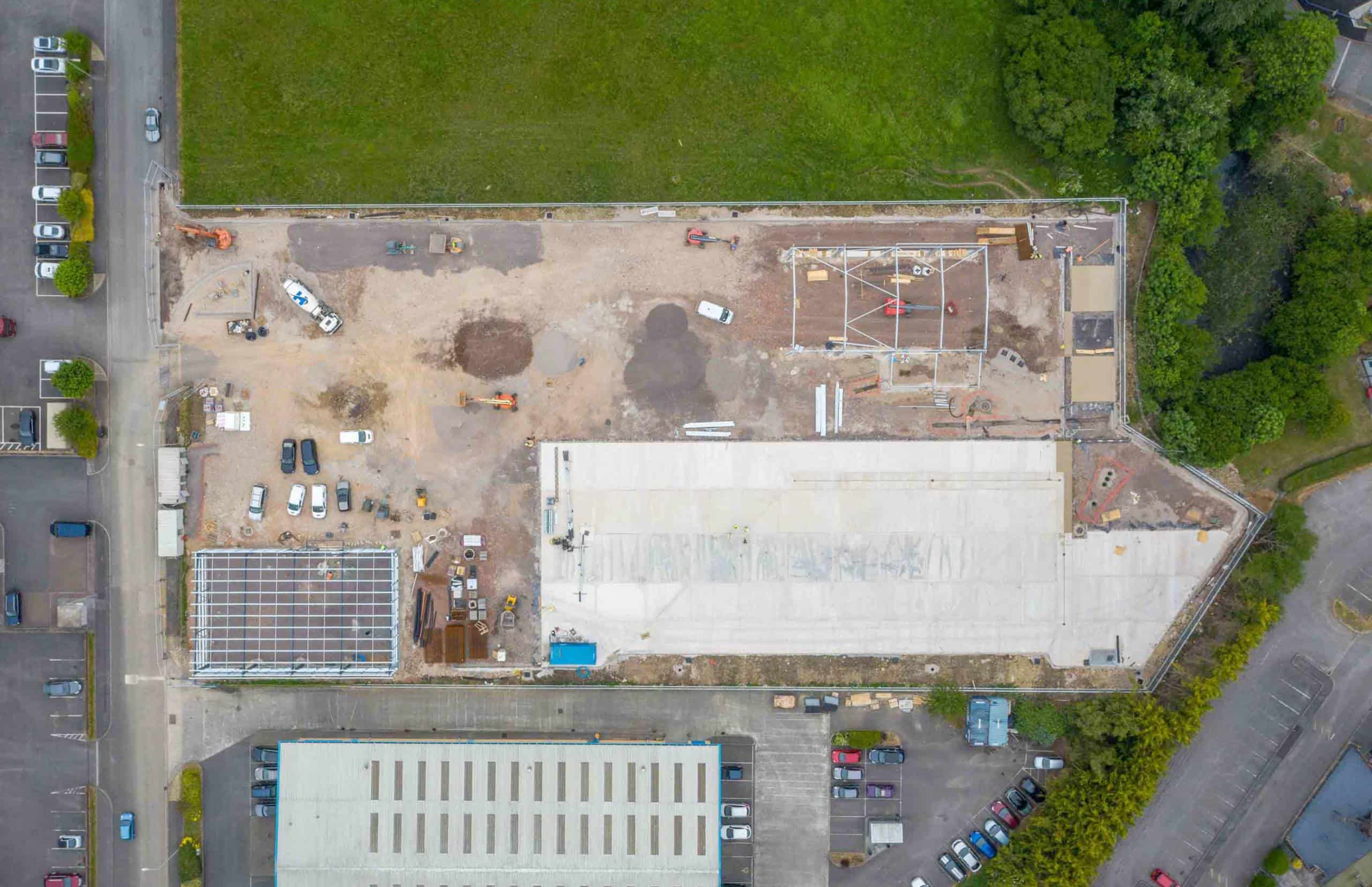
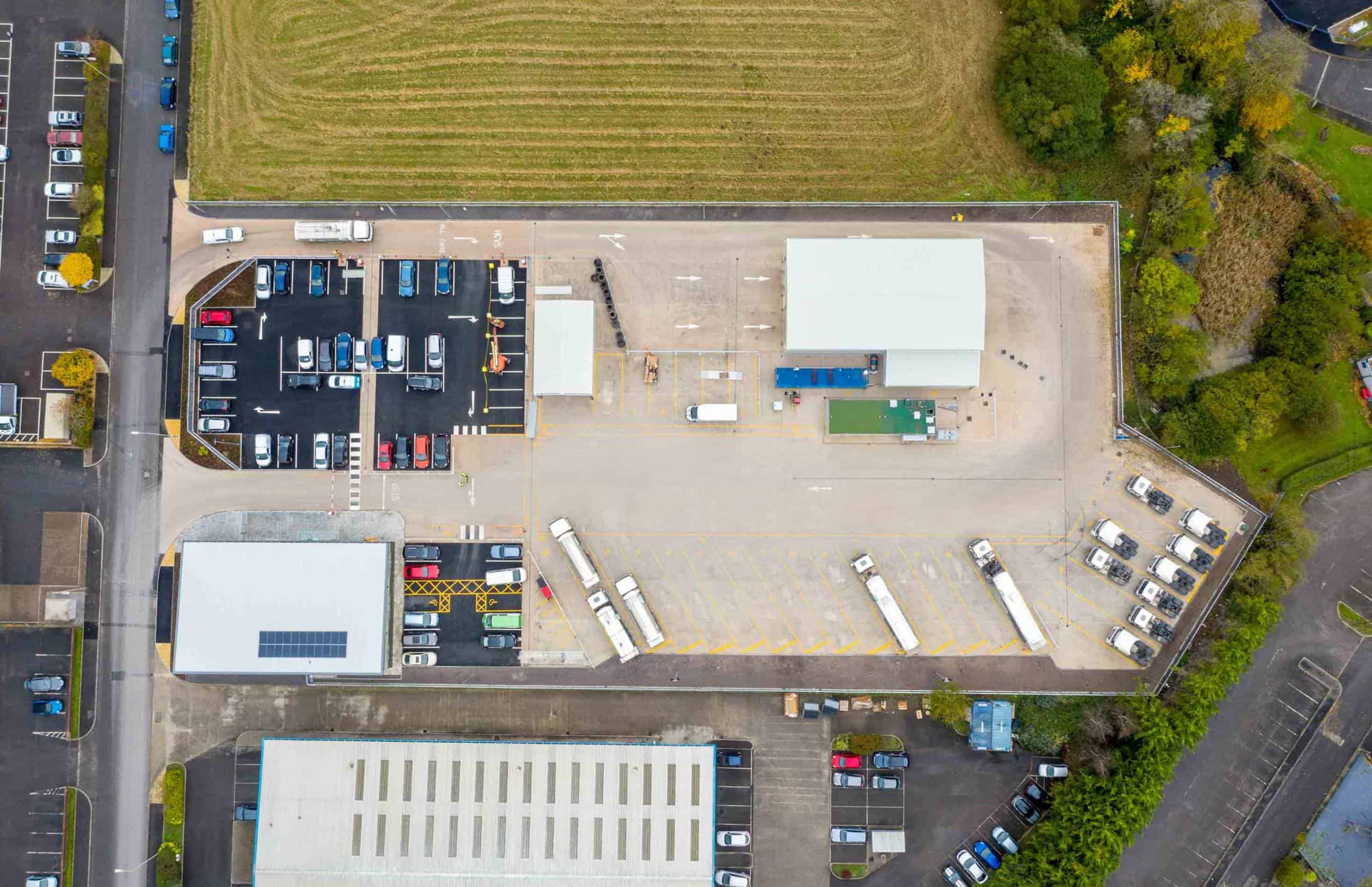
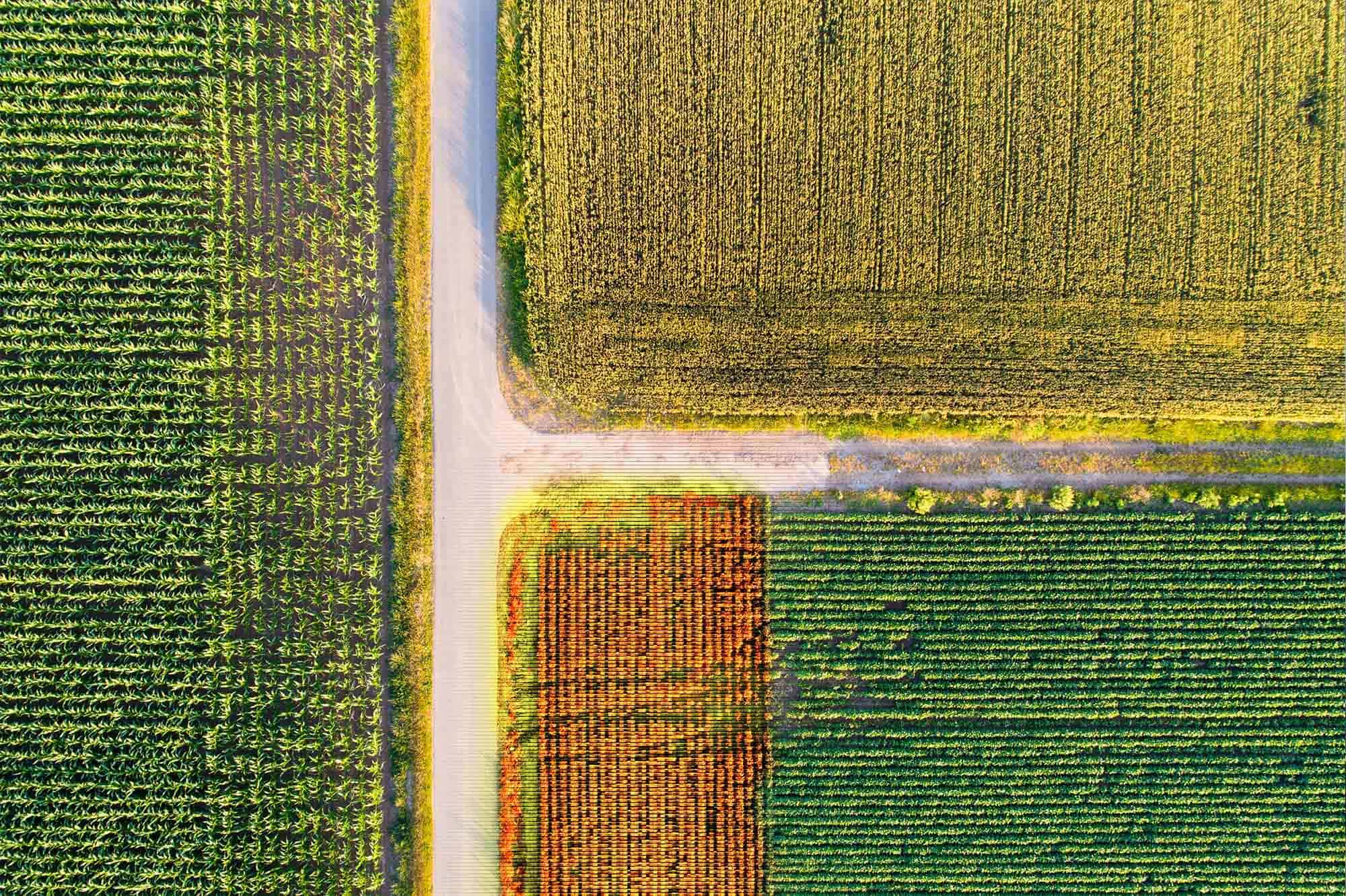
Topographical Maps
We undertake orthomosaic mapping, which is bespoke to the requirements of the client. This is achieved by condensing several hundred images together to generate a geometrically corrected, yet detailed map.
Images are provided in an aerial format and through elevation, metric and seasonal information. Produced in either long-distance or macro detail, these maps can be extremely beneficial for planning purposes and progress reporting. Sectors which benefit from this approach include:
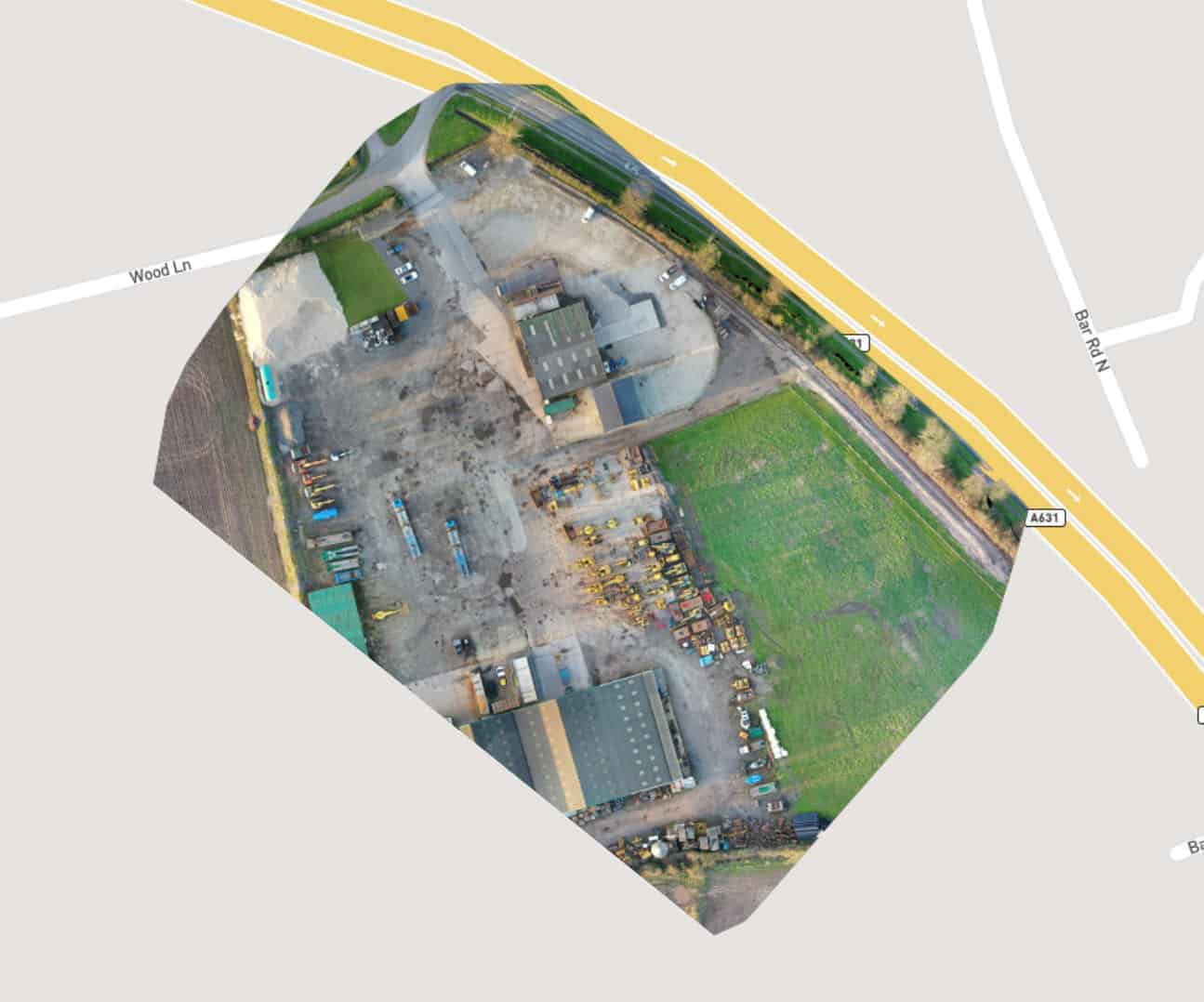
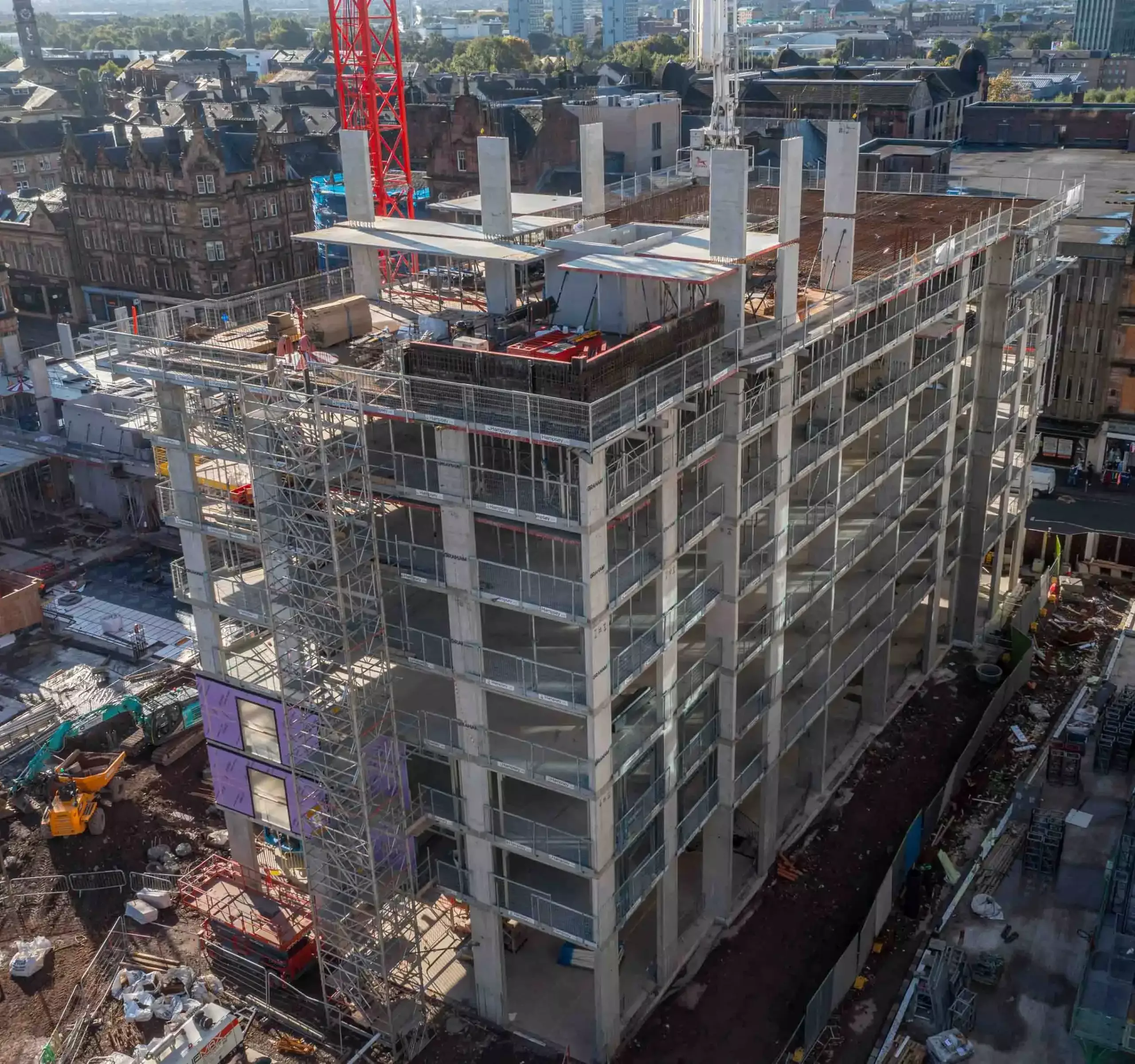
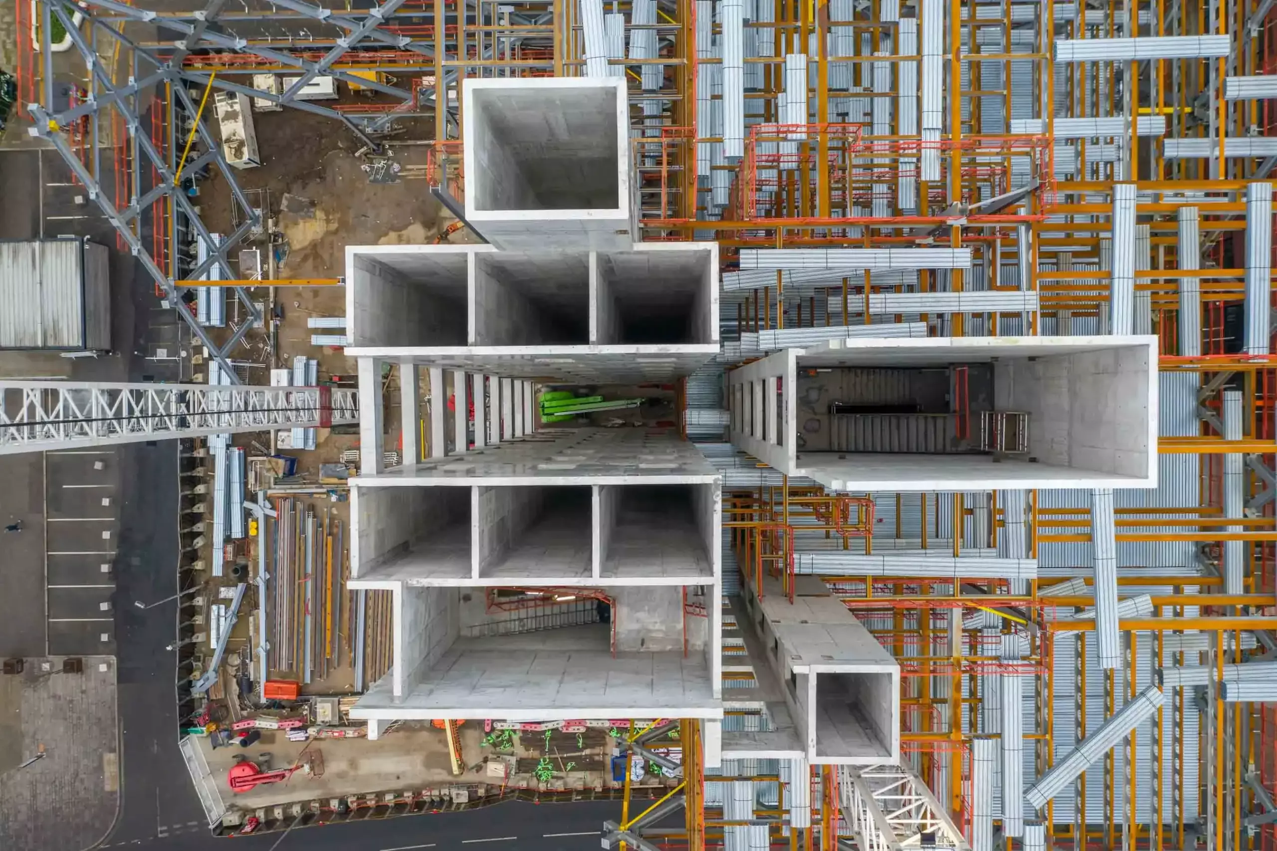
3D Modelling
Using the latest photogrammetry technology, we produce detailed three-dimensional representations of actual environments. They are created by combining hundreds of images using Point Clouds and 3D Textured Meshes, enabling them to appear real. The level of detail is determined by the GSD (Ground Sampling Distance). This is the number of pixels measured in relation to the ground; down to 1.4cm per pixel. The benefits include:

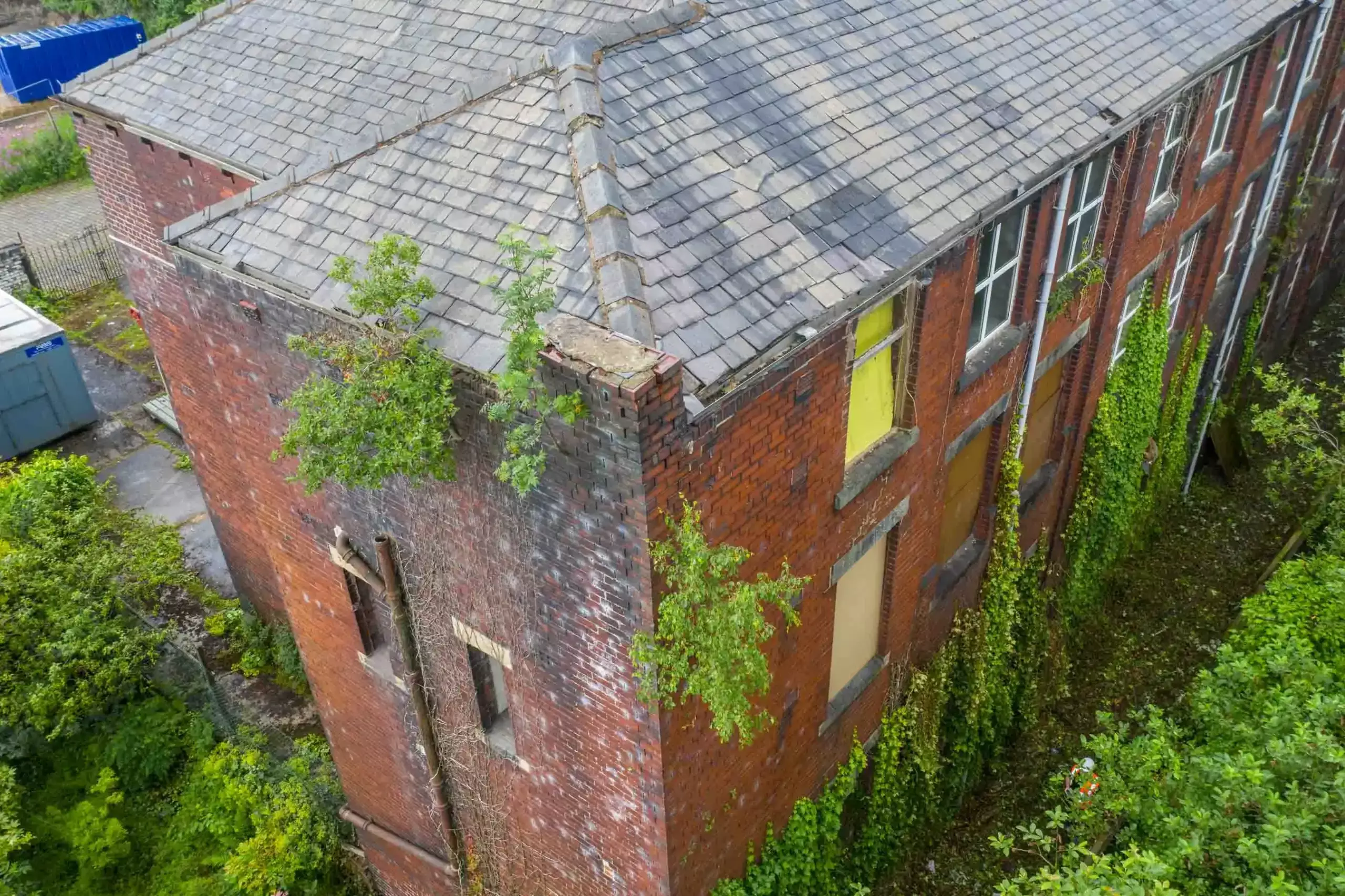
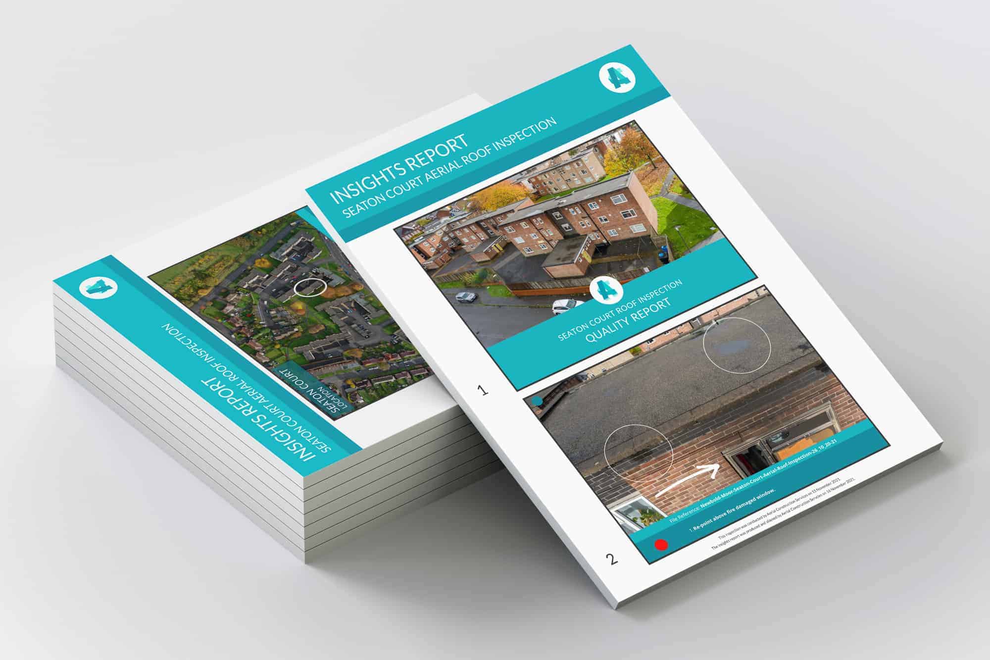
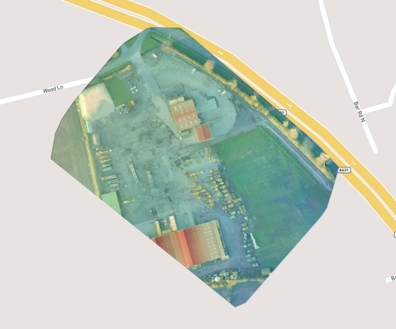
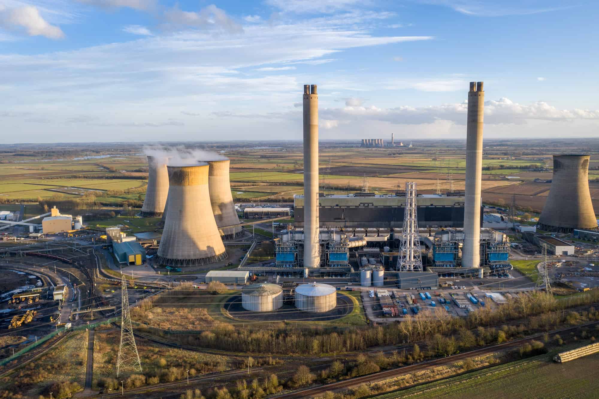
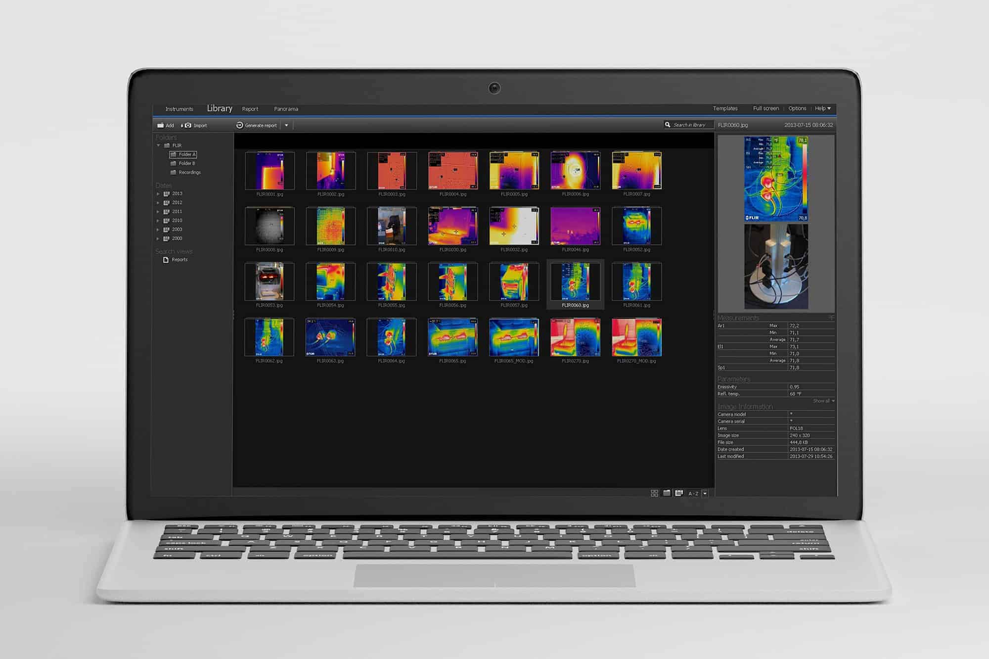
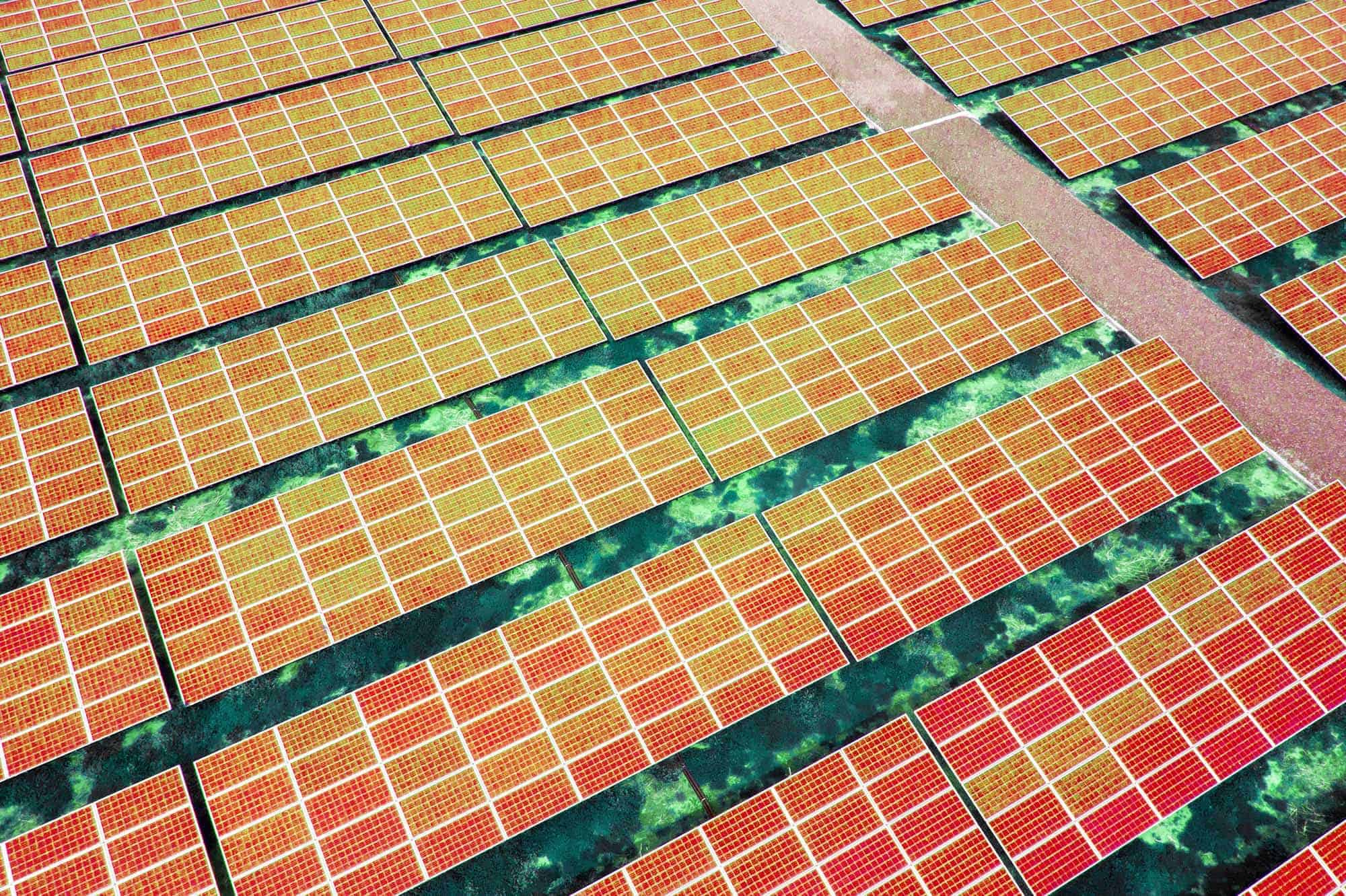
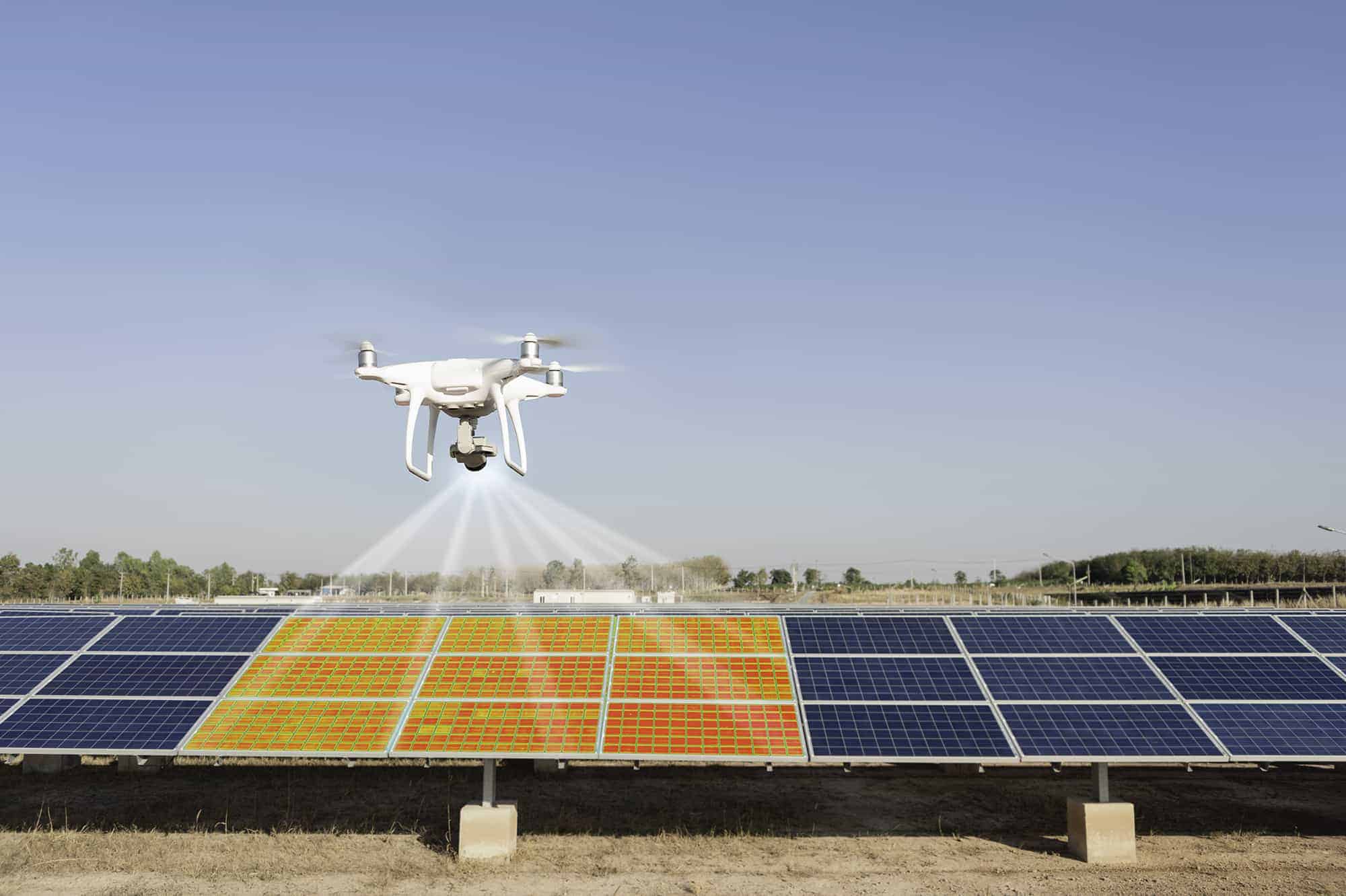
Thermal Imaging
Using specialist thermal sensors combined with FLIR software (the world’s leading thermal sensor producer), we are able to detect costly heat loss issues not visible to the naked eye in a timely manner. Operations include:
Following every thermal inspection, we provide a comprehensive condition report highlighting specific areas where action needs to be taken. This ultimately saves our clients time and money enabling them to make informed decisions.
Aerial Filming
Aerial filming and photography are the most effective forms for marketing and business development. Our aerial footage provides a unique perspective, allowing clients to communicate projects to others effectively.
Our experienced award-winning cinematographers deliver an unrivalled service by using the latest technologies. We film in 4K, photograph in high-definition, automatically track and follow objects, and produce timelapse imagery if requested.
We are dedicated to construction and housing and hold the relevant CAA licenses and requisite insurances, allowing us to fly legally and safely.
Topographical Maps
We undertake orthomosaic mapping, which is bespoke to the requirements of the client. This is achieved by condensing several hundred images together to generate a geometrically corrected, yet detailed map.
Images are provided in an aerial format and through elevation, metric and seasonal information. Produced in either long-distance or macro detail, these maps can be extremely beneficial for planning purposes and progress reporting. Sectors which benefit from this approach include:
3D Modelling
Using the latest photogrammetry technology, we produce detailed three-dimensional representations of actual environments. They are created by combining hundreds of images using Point Clouds and 3D Textured Meshes, enabling them to appear real. The level of detail is determined by the GSD (Ground Sampling Distance). This is the number of pixels measured in relation to the ground; down to 1.4cm per pixel. The benefits include:
Thermal Imaging
Using specialist thermal sensors combined with FLIR software (the world’s leading thermal sensor producer), we are able to detect costly heat loss issues not visible to the naked eye in a timely manner. Operations include:
Following every thermal inspection, we provide a comprehensive condition report highlighting specific areas where action needs to be taken. This ultimately saves our clients time and money enabling them to make informed decisions.
Common Questions
Let’s Fly Together
Opening Hours
Monday
Tuesday
Wednesday
Thursday
Friday
Saturday
Sunday
Monday
Tuesday
Wednesday
Thursday
Friday
Saturday
Sunday
8:00 am – 6:00 pm
8:00 am – 6:00 pm
8:00 am – 6:00 pm
8:00 am – 6:00 pm
8:00 am – 6:00 pm
8:00 am – 6:00 pm
Closed